
‘Keeping an eye on river levels’
Snowmelt raises rivers, but Marshall area not a risk
Trending
MARSHALL -- High temperatures and melting snow are swelling rivers in Minnesota this week, the National Weather Service said. But while communities like New Ulm are under flood warnings, the impact of the melt isn't that severe in Lyon County, area officials said.
"We're keeping an eye on river levels," Lyon County Emergency Manager Emily Coequyt said Monday afternoon. But as of right now, she said, it didn't look like there was much risk of flooding in the Marshall area.
"We have had a couple reports of water going over township roads for short periods of time," Coequyt said. She cautioned area residents not to drive on roadways covered by water, because the water could hide a washout underneath the surface.
Temperatures in the Marshall area are forecast to get into the 80s and high 70s this week, the NWS said. The heat wave was already making short work of snow around Marshall on Monday, and the Redwood River was flowing through town. However, river levels were still well below flood stage.
The Redwood River was observed at a stage of over 11 feet in Russell and over nine feet in Marshall on Monday morning, NWS data said. Flood stage at both locations is 14 feet.
The NWS forecast that the river level would peak around 11.9 feet in Marshall today, and drop over the course of the rest of the week.
Meanwhile, the communities of Morton in Redwood County and New Ulm and Springfield in Brown County are currently under a flood warning, the NWS said. The Cottonwood River at New Ulm was expected to rise above its flood stage of 11 feet on Monday, and crest at 12.5 feet on Wednesday morning. The Minnesota River at New Ulm is not expected to get above flood stage, but it's close, the NWS said. The river was measured at over 791 feet on Monday morning, compared to its flood stage of 800 feet.
New Ulm Emergency Management Director Dave Borchert said the city is monitoring river levels and possible flooding. He said expected crests don't cause problems now but more rainfall could change that.
"The Cottonwood's expected crest at 11.5 feet is below levels that cause problems for us," said Borchert. "For example, at 13 feet, the Cottonwood goes over the street and requires us to close the road. The Minnesota expected crest later this week will not cause any mitigation steps."
Minor flooding is also forecast on the Minnesota River at Morton, the NWS said. The river stage was expected to rise to nearly 23 feet on Friday morning and then fall, but remain above flood stage. The crest compares to a previous crest of 22.8 feet in August 2016, the NWS said.
Marshall Mayor Bob Byrnes said city staff and emergency responders were watching the level of the Redwood River carefully, although it doesn't look like it poses much risk right now.
"This week, the melting is happening very rapidly," Byrnes said. "However, a couple things work in our favor." Byrnes said the fall soil conditions around Marshall were dry, and the frost level was light and shallow. Those factors made it more possible to absorb melting snow.
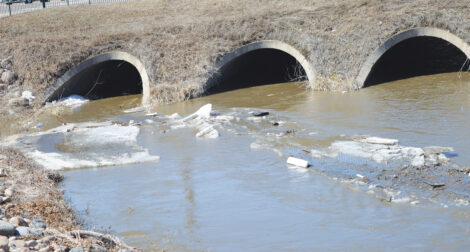
"The wild card is ice jams" on area rivers, Byrnes said. So far, that didn't seem to be a problem either, he said.
Scott Truedson, superintendent of the Marshall wastewater facility, said flows were looking good at the facility on Monday. With how dry the area's soil has been this year, the sanitary sewer system was not seeing a lot of infiltration by melting snow, he said. A pump at the city's Tiger Lake retention pond had come on a couple of times over the past day, but that wasn't a heavy level of activity, he said.
-- Fritz Busch
contributed to this
report